New piracy update
Jeppesen Marine has teamed up with a specialist in geopolitical risk, Bergen Risk Solutions, to develop an information service that will enable shipping companies and officers to minimize the likelihood of pirate attack. The resulting piracy update offers subscribers a daily report that displays recent pirate activity on navigational charts used for route planning. The piracy update is available on a subscription basis for the shipping office environment or the bridge planning station.
Denne artikkelen er tre år eller eldre.
“Digital charts from Jeppesen Marine provide the ideal platform to put value-added information in front of decision-makers in maritime operations,” said Bjørn Åge Hjøllo of Jeppesen Norway. “We have demonstrated the value of timely weather and sea-state forecasts; now we do it with piracy information. With these updates, bridge officers get the information they need in nearly real-time, so that they can take appropriate action.”
The piracy update is collated by the maritime security specialists of Bergen Risk Solutions daily, including information about all attacks worldwide over the past week, and historically. This information is formatted by Jeppesen Marine, and delivered via Internet download or email in a single file of less than 100 kilobytes using Jeppesen Marine’s new highly compressed data format.
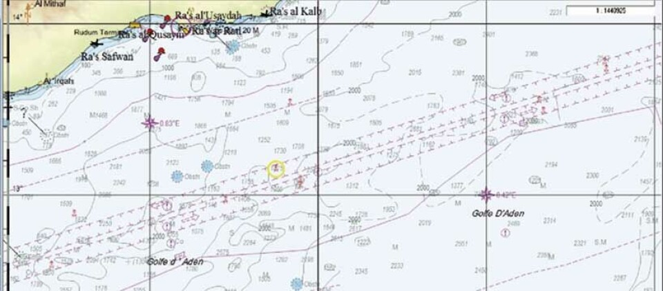
Once uploaded on a computer using Jeppesen Marine’s C-MAP OceanView software or on a compatible ECS or ECDIS, the chart-user will have the option to view the up-to-date piracy notices in the chart. On screen, attacks appear by latitude and longitude, the result (approach, attack, boarding, etc.) and the date. High risk zones and naval escorts in, for example, the Gulf of Aden and Niger Delta are also represented in the navigational chart. Finally, additional information such as wave height can also be superimposed on the chart. This can help shipping companies plan passages, as pirates’ high-speed vessels are ineffective in wave heights over 1.5 meters.
Jeppesen Marine believes that combining piracy information, with its high-quality chart products and weather updates, makes a very compelling argument. “Pirate attacks occur in certain areas, and under certain weather, light and timing conditions. By putting chart, weather and pirate information together at the fingertips of route planners, we help them find solutions that lower their risk,” said Hjøllo.


